There are 1 Union Territory and 6 neighbouring states to touch Maharashtra border. Maharashtra is bordered by the Arabian Sea and the Indian states of Gujarat, Madhya Pradesh, Chhattisgarh, Telangana, Karnataka, Goa and the Union territory of Dadra and Nagar Haveli. 1 UT and 6 states are touching the border of Maharashtra.
Maharashtra lies in the western region of India. Mumbai is the capital of Maharashtra while Nagpur is regarded as the second capital of Maharashtra. Maharashtra (third largest state by area) covers an area of 307,710 square kilometers. Maharashtra is one of the wealthiest and the most developed states in India, contributing 25% of the country’s industrial output.
Table of Contents
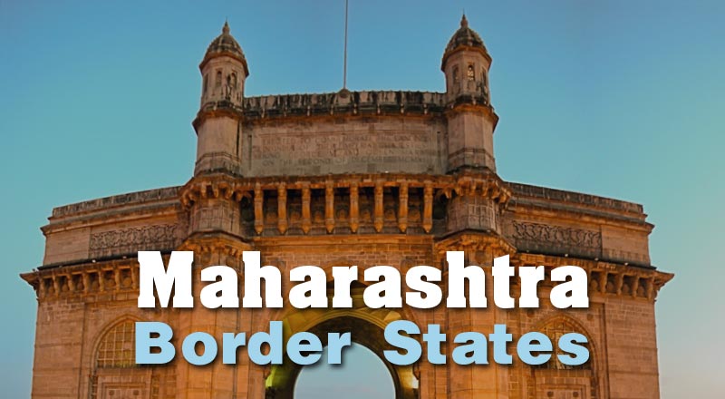
6 States Touch Maharashtra Border
Gujarat, Madhya Pradesh, Chhattisgarh, Telangana, Karnataka and Goa are the neighbouring states of Maharashtra. UT of Dadra and Nagar Haveli also touches the Maharashtra border.
| No. | Name | Division Type | Location |
|---|---|---|---|
| 1 | Gujarat | State | North |
| 2 | Madhya Pradesh | State | North |
| 3 | Chhattisgarh | State | East |
| 4 | Telangana | State | South |
| 5 | Karnataka | State | South |
| 6 | Goa | State | South |
| 7 | Dadra and Nagar Haveli | Union Territory | North |
| 8 | Arabian Sea | Sea Region | West |
Map of Maharashtra Border and Neighbouring States
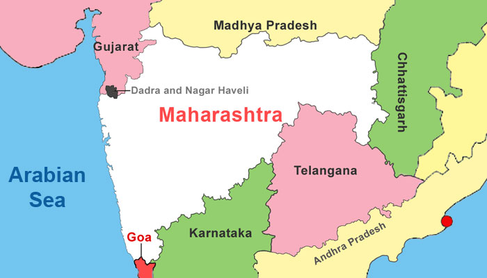
Maharashtra is bounded to the north by the Union Territory of Dadra and Nagar Haveli and the Indian states of Gujarat and Madhya Pradesh and the south by the Indian states of Telangana, Karnataka and Goa and the east by the Indian state of Chhattisgarh and the west by the Arabian Sea of the Indian Ocean. 7 administrative sub-divisions of India (1 union territory and 6 states) are surrounding Maharashtra.
Question: How many states touch Maharashtra border?
Answer: Maharashtra shares its border with as many as 6 states. Arabian Sea, 1 Union Territory and 6 Indian States are touching the boundary of Maharashtra.
Facts about Maharashtra Border
Telangana replaced Andhra Pradesh from the list of Maharashtra bordering states after Telangana was carved out of Andhra Pradesh in 2014. The Arabian Sea makes up Maharashtra’s west coast. The Konkan division is an administrative sub-division of Maharashtra which comprises all the coastal districts of the state. The Satpuras, hills along the northern border, and the Bhamragad-Chiroli-Gaikhuri Ranges on the eastern border form physical barriers preventing easy movement, but also serve as natural limits to the state.
The Cabinet Committee on Economic Affairs has given fresh approval for three national highway projects on the Maharashtra Gujarat border.
Banda is a town in Sindhudurg district in Maharashtra, India near the Goa Maharashtra border. Banda is the last town of Mahrashtra state on Mumbai-Goa national highway (NH-17).
Terekhol river acts as a Maharashtra Goa border because it forms the boundary between Sindhudurg district of Maharashtra state and North Goa district of Goa state for some distance.
Belgaum, sitting on Karnataka Maharashtra border, is the disputed city of Karnataka.
NH3 (Maharashtra Madhya Pradesh border via Dhule-Nashik-Thane) saw 920 fatalities in 2014-15. However, a survey suggests 21% drop in accidents on Mumbai-Pune Expressway than last year.